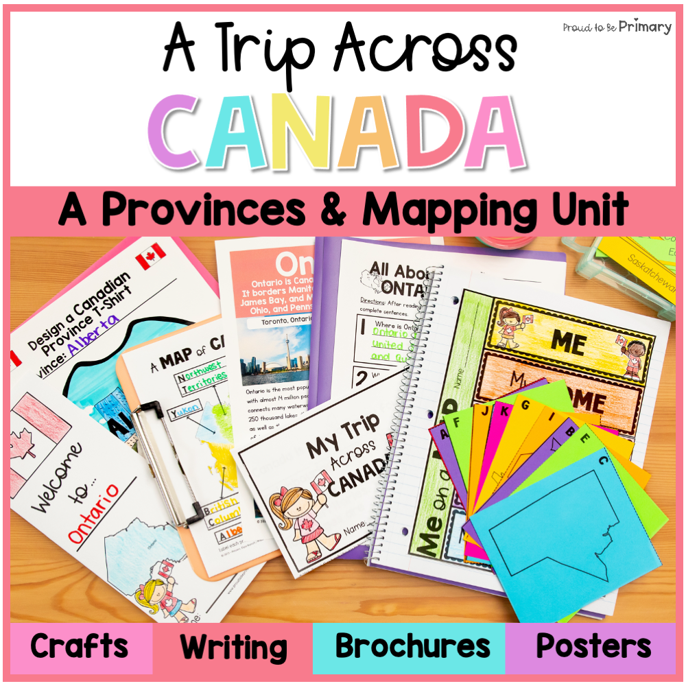
Do you need an engaging Canada Province, Territories, & Mapping unit to teach your students all about Canadian geography? This Canadian Geography Unit has 135 pages of social studies activities to teach your first grade, second grade, or third grade students about the 13 Canadian provinces and territories, and all about Canadian geography and mapping!
⭐️ This Canadian geography unit includes tons of fun ways to learn the map of Canada, as well as lessons, full-colour posters for each province and territories, question sheets, activities, a printable mini-book, and more.
⭐️ This comprehensive unit is great for Canadian classrooms and International classrooms learning about Canada.
This Canada Geography Resource Includes:
Canadian Provinces & Territories
- KWL & Schema Headers & Sheets
- Questions Sheet (ask questions before, during, and after the unit)
- Full-colour fact posters for all 13 Canadian provinces and territories
- Question sheets (great for Close reading activities) for every province and territory.
- My Trip Across Canada Mini-Book (15 page book to fill-in the blanks on each page about important facts)
- Design a Canadian T-Shirt Templates
- Province & Territory Pamphlets (create a visitor's pamphlet with instructions on assembly)
- Province & Territory Writing Paper
- Research Template
- Report Template
- Postcard & Stamp Templates
Canadian Mapping
- Full Colour Map of Canada
- Foldable Map Book (me/home/province/country)
- Me on a Map Interactive Notebook
- Me on a Map Anchor Chart Headings
- Differentiated Maps of Canada (3) to Label & Colour
- Canada Match Game (land, name, and capital city)
Look at the PREVIEW for a 4 page look of the activities and materials provided in this pack.
⭐️ Bundle & save for a discount ⭐️
Buy the BUNDLE and SAVE 30%! The Canada Resource Bundle is a collection of two resources filled with Canadian geography and symbol activities.
TEACHER'S LIKE YOU HAVE SAID...
⭐️ ⭐️⭐️⭐️⭐️ Victoria C. says, "This was great to supplement our unit about Canada."
⭐️⭐️⭐️⭐️⭐️ DK Kindergarten Creations says, "My students loved learning about Canada and this resource allowed me to differentiate learning for my higher and lower learners so that everyone was working at their own level."
Stay connected with Proud to be Primary
♥Never miss a sale or new release! Click the star to follow my store!
♥Join our email list and get exclusive content and FREE resources.
♥Visit our website at Proud to be Primary for engaging ideas!
Please read the description, review the preview file, and read the FAQ in our Help Center carefully before purchasing.
Question not answered? Reach out to support at support@proudtobeprimary.com.
All digital sales on Proud to be Primary of resources are considered final and non-refundable.
© Copyright Proud to be Primary, Elyse Rycroft. All rights reserved. Permission is granted to copy pages specifically designed for student or teacher use by the original purchaser or licensee. This product is licensed for personal classroom use ONLY unless multiple licenses are purchased. The reproduction, alteration, adaptation, copying, or sale of any part of this product is strictly prohibited. Read the full Terms and Conditions HERE.